Scenic Helicopter Tours: Explore Aerial Views, Routes, and Travel Experiences
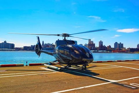
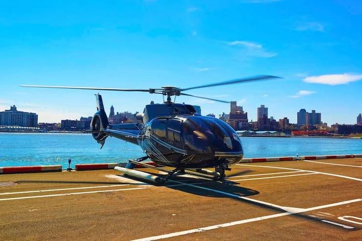
Scenic helicopter tours provide a way to view landscapes, cities, coastlines, mountains, and other destinations from above.
These flights generally follow planned routes designed around notable geographical or cultural features, giving passengers an aerial perspective that is difficult to experience from ground level. Scenic helicopter tours can range from short flights around a city to longer journeys covering natural landscapes and multiple points of interest.
Context
Understanding Scenic Helicopter Tours
A scenic helicopter tour is a planned passenger flight focused primarily on viewing the surrounding landscape. Unlike transportation flights, the purpose is generally the aerial experience itself, with routes selected to provide views of recognizable landmarks, natural formations, waterways, or urban areas.
Helicopters are particularly suited to this type of travel because they can operate at relatively low altitudes compared with many fixed-wing aircraft and can follow varied routes. Their ability to hover, turn within a limited area, and access locations without conventional airport runways makes them suitable for sightseeing operations.
The development of helicopter sightseeing became more common as civilian helicopter operations expanded after the middle of the twentieth century. Over time, tourism operators developed routes around destinations known for distinctive scenery, including mountain ranges, national parks, coastal areas, major cities, and island landscapes.
What a Typical Flight Involves
A scenic flight usually begins with passenger check-in and a safety briefing. Passengers are then assigned seats according to aircraft configuration, weight distribution, and operational requirements. The pilot provides instructions concerning seat belts, communication, movement inside the aircraft, and emergency procedures.
The flight follows a predetermined route, although the exact path can sometimes change because of weather, air traffic, temporary restrictions, or operational considerations. Some tours include commentary through headsets, allowing passengers to learn about landmarks and geographical features during the journey.
Flight duration varies according to the route and aircraft. A short urban flight may cover a relatively small area, while a longer excursion can include several landscape types.
| Tour type | Typical focus | Common viewing areas |
|---|---|---|
| Urban flight | Buildings and landmarks | City centers, skylines |
| Coastal flight | Shorelines and waterways | Beaches, cliffs, islands |
| Mountain flight | Natural landscapes | Peaks, valleys, glaciers |
| Canyon flight | Geological formations | Canyons, plateaus |
| Regional flight | Multiple attractions | Mixed landscapes |
How Routes Are Planned
Route planning considers several factors, including aviation regulations, local airspace, weather, terrain, aircraft capabilities, and passenger viewing opportunities. Pilots and operators must also account for airports, restricted areas, population centers, and other aircraft operating in the region.
A route may appear simple on a map but involve several operational considerations. The aircraft must maintain appropriate separation from obstacles and other aircraft while complying with applicable aviation rules.
Importance
Why Aerial Views Matter
Aerial travel changes how familiar places are perceived. Roads, rivers, coastlines, buildings, forests, and mountain formations can form recognizable patterns when viewed from above, helping passengers understand the relationship between different parts of a landscape.
For travelers, scenic helicopter tours can also provide an alternative perspective when ground access is limited. Certain geographical features may be difficult to observe clearly from roads or walking routes because of terrain, vegetation, distance, or restricted access.
Planning Around Everyday Travel Needs
Several practical factors can affect the experience. Weather is particularly important because visibility, wind, cloud cover, and precipitation can influence flight operations and views.
Passengers may also need to consider:
- Aircraft seating arrangements and available window positions
- Weight and baggage restrictions
- Accessibility requirements
- Flight duration and route coverage
- Seasonal weather patterns
- Photography and electronic-device rules
- Airport or departure-location requirements
Planning these details helps travelers understand what to expect without assuming that every flight will follow an identical route.
Safety and Passenger Awareness
Helicopter operations are governed by aviation regulations, pilot qualifications, aircraft maintenance requirements, and operational procedures. Passengers should follow all instructions given before and during the flight.
Weather can change quickly, particularly in mountainous and coastal areas. For this reason, a planned route may sometimes be adjusted or a flight may be postponed when conditions do not support normal operations.
Recent Updates
Technology and Flight Planning Trends
From 2024 through 2026, the broader sightseeing aviation sector has continued adopting digital tools for reservations, passenger communication, weather monitoring, and route planning. Electronic information systems can make it easier to provide passengers with operational updates and itinerary information.
Modern navigation technology also supports more precise flight planning. Pilots can use digital mapping, satellite-based navigation, terrain information, and weather data as part of established aviation procedures.
Aircraft Efficiency and Passenger Experience
Aircraft manufacturers and operators continue to explore ways to improve fuel efficiency, reduce noise, and lower environmental impacts. Developments in rotorcraft design, engine technology, materials, and operational planning are part of a wider aviation effort to improve efficiency.
Noise remains an important consideration for helicopter operations, particularly around populated areas and environmentally sensitive locations. Some operators and aviation authorities have introduced or refined procedures intended to manage noise exposure and maintain appropriate flight paths.
Digital Travel Planning
Travelers increasingly research routes, departure points, weather conditions, aircraft layouts, and passenger requirements online before arriving at the departure location. Digital maps and interactive route information can help people understand which landscapes may be visible during a flight.
However, online photographs should not be treated as a guarantee of the views available on a particular journey. Weather, route changes, seasonal conditions, and visibility can affect what passengers see.
Tools and Resources
Mapping and Route Tools
Digital mapping platforms can help travelers identify landmarks, coastlines, mountain ranges, and other geographical features along a proposed route. Satellite imagery can provide additional context about the landscape surrounding a departure location.
Weather Resources
Weather applications and aviation-focused weather information can help passengers understand visibility, wind, cloud cover, and precipitation around a planned flight. Local conditions remain particularly relevant for helicopter operations because terrain can influence weather patterns.
Travel Planning Platforms
Online travel platforms can provide information about departure locations, available flight durations, aircraft details, passenger requirements, and route descriptions. Travelers can compare this information with maps and destination guides to understand the overall itinerary.
Photography Preparation
A camera or smartphone can document an aerial journey, although aircraft windows, reflections, vibration, and changing light can affect image quality. Checking photography rules before departure is useful because some aircraft or flight operations may restrict particular equipment or activities.
FAQs
What are scenic helicopter tours?
Scenic helicopter tours are planned flights designed primarily for viewing landscapes, landmarks, cities, coastlines, mountains, or other attractions from the air.
How are scenic helicopter tours and routes planned?
Routes are developed around aviation regulations, airspace restrictions, terrain, weather, aircraft capabilities, and locations that provide meaningful aerial views.
Are scenic helicopter tours affected by weather?
Yes. Visibility, wind, cloud cover, precipitation, and other weather conditions can affect flight operations and the quality of aerial views.
How long do scenic helicopter tours usually last?
Flight durations vary according to the route, destination, aircraft, and operating conditions. Short sightseeing flights may cover a limited area, while longer routes can include several attractions.
Can passengers take photographs during scenic helicopter tours?
Photography is commonly possible, but passengers should follow aircraft-specific instructions. Reflections, vibration, window conditions, and changing light can influence photographs.
Conclusion
Scenic helicopter tours provide an aerial way to experience cities, coastlines, mountains, and other landscapes from a different perspective. Routes are shaped by aviation rules, weather, terrain, aircraft characteristics, and sightseeing objectives. Recent developments have included greater use of digital planning tools, navigation technology, and ongoing attention to aircraft efficiency and noise management. Understanding route details, weather conditions, passenger requirements, and photography considerations can provide useful context for this type of travel experience.